The River Avon at Bristol, Avonmouth and Portishead.
Things to do at Bristol including visiting Clifton Suspension Bridge, walking to Pill and perhaps a drive out to Portishead.
Naturally the area immediately around Brunel's beautiful Suspension Bridge is very popular and finding somewhere to park close to the bridge is not very easy - especially on Sundays. There is usually somewhere to park along Clifton Down Road though ( see this map ) - then it's just a few minutes walk to the bridge. If you look at the map you can see that walking across the open area will take you to Clifton Observatory which is perched above the gorge and bridge - with some excellent view of course.[ Click the thumbnails to see a larger picture - use the back button to return here. ]
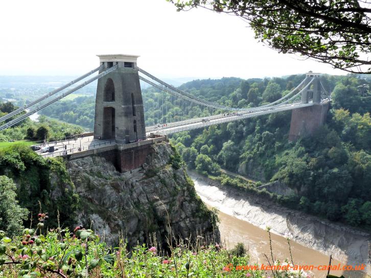

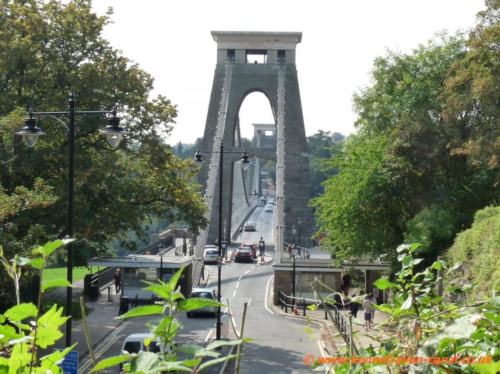
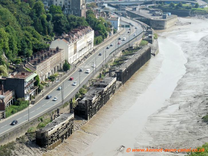
From here you really do get to appreciate the design and engineering brilliance of Isambard Kingdom Brunel. From the Observatory simply follow the obvious path down onto the B3129 and take a walk across Clifton Suspension Bridge - free of charge for walkers and cyclists (this is a toll bridge and cars are currently charged UKstg1 to go over it). About the bridge: Clifton Suspension Bridge is 245 feet above the high tide level of the River Avon and has a single span of 702 feet. It was designed by Brunel but
not completed until 1864 (i.e. five years after his death). Interestingly the bridges suspension chains originated from Hungerford Suspension Bridge (in London) when that bridge was demolished and replaced by Charing Cross Railwaybridge.
Walking or cycling from Bristol Entrance Lock to Pill passing under Brunel's Clifton Suspension Bridge on the way and then onto the M5 Bridge which spans the River Avon.
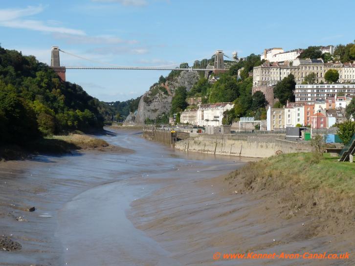
From the west side of Bristol around Entrance Lock (and the western end of the Kennet and Avon Canal) there are great views of the River Avon and in the distance Clifton Suspension Bridge which crosses the gorge. (the path to Pill goes right under the bridge). Pill is situated on the X2 Bristol to Portishead bus route with a service running every 30 minutes therefore doing this as a one way walk is pretty simple.The following indicates the route if walking or cycling from Entrance Lock at Cumberland Basin in Bristol along the river to Pill.
Clifton Suspension Bridge
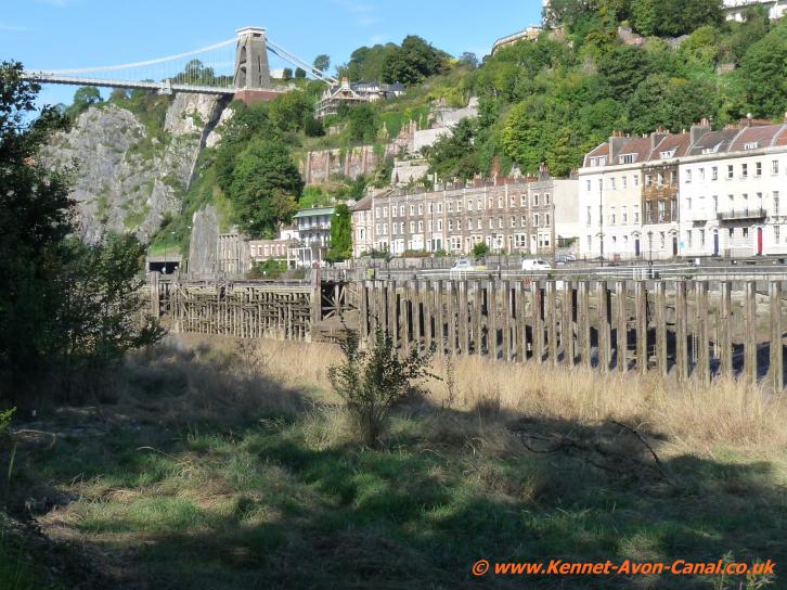
River Avon Clifton

Clifton
Suspension Bridge
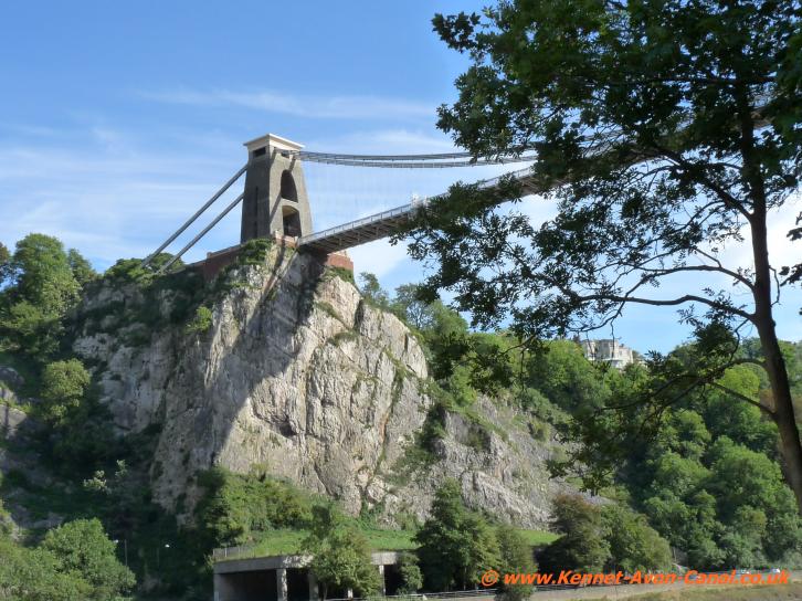
Clifton
Suspension Bridge
The walking path to Pill is on the other side of the river therefore cross over the locks area and then go over the River Avon via the adjacent A3029 road bridge. Take the concrete pathway going off from the bridge onto the grass area and commence walking
alongside the river-bank on a well marked path. Accompanied by a single-track railway line on the left, this is a beautiful tree-lined path which stays very close to the river - Clifton Suspension Bridge is ahead and makes a lovely site as it crosses high over the gorge. Some way after going under the suspension bridge the trees end and the path goes through a very open area - but still remains very close to the river.
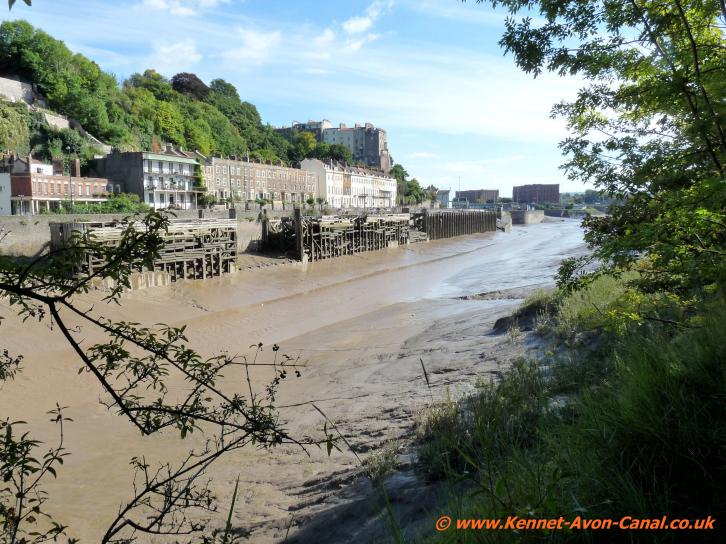
Lowtide at Bristol -
i.e. oozy muddy River Avon

River Avon Clifton -
Kestrel.
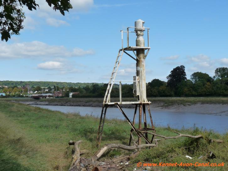
Avon Navigation
beacon
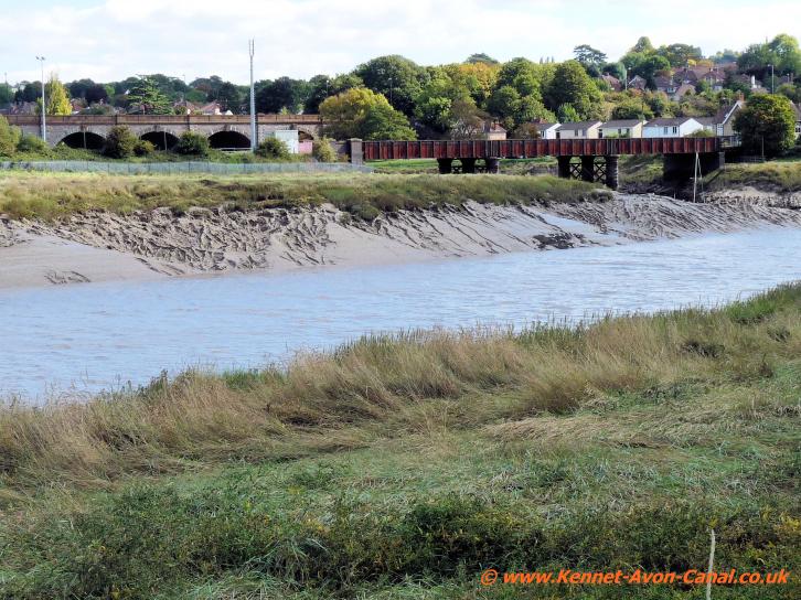
Sea Mills bridges
The river and path then take a quite tight left bend and a short distance after it all straightens up again just by a small muddy inlet/creek the path heads away from the riverbank soon going past Ham Green Lakes and meets Chapel Pill Lane. Follow this narrow lane into Ham Green - at the end of the lane cross over Mcrae Road and then over the grassy area - the path crosses another road, more green area then climbs a little above the railway line to then drop back into Pill and it's small harbour.
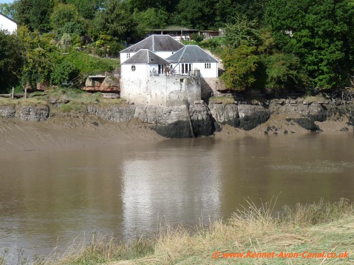
Avon river-side house
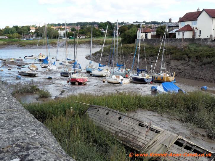
The small harbour
at Pill
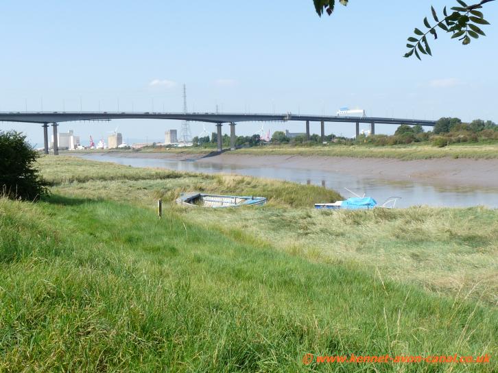
Avonmouth Bridge
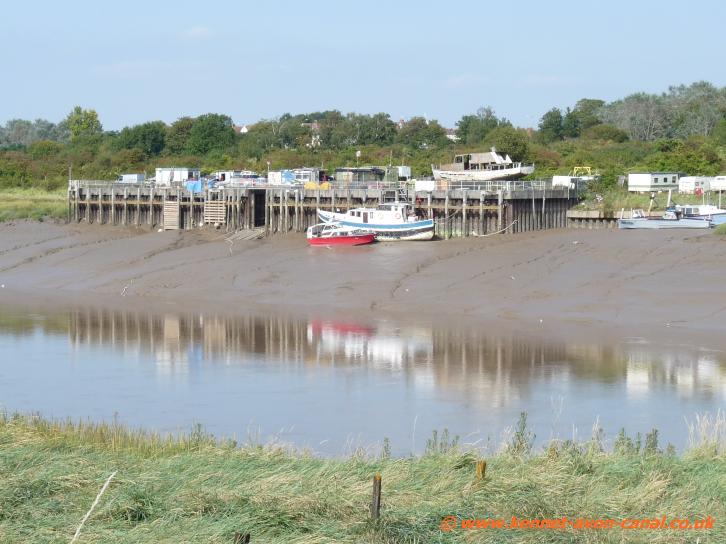
The River Avon
Pill is a really pleasant and picturesque area by it's harbour - even if the tide is out and the mud has taken
over - there are several pubs which are often quite busy during weekends. In the past Pill was the base for the majority of the pilots who used to guide sea-going ships between the Bristol Channel and Bristol Docks via the dangerous waters of the Avon Gorge. A ferry at one time operated between Pill and Shirehampton but this was retired once the Avonmouth Bridge was constructed - also the area around Pill was once (100s of year ago) famous for having a large pottery known as Ham Green pottery.
Avonmouth Bridge can be seen a little way downstream and it is possible to walk or cycle onto and/or across this busy M5 motorway roadbridge - therebye getting really good views of the River Avon from high up. To do this go to the leftside of
Pill Harbour and down to the river - turn left and follow the road (Marine Parade) alongside the river. If cycling then follow the Cycle Route 41 sign on round the road - it's all clearly marked. However if
walking you can continue on a path which goes alongside the river for a while - there are good views of the Avonmouth Bridge from here. When the houses end turn left and follow the path up to Avon Road and re-join the cycle route. Now simply follow this as it goes under a railway bridge and then arrives at the Avonmouth Bridge. A winding cycle and walking path then takes you up onto the bridge - there is a shielded walkway right across the bridge and there are some excellent views of the River Avon and so on from here.
To do this go to the leftside of
Pill Harbour and down to the river - turn left and follow the road (Marine Parade) alongside the river. If cycling then follow the Cycle Route 41 sign on round the road - it's all clearly marked. However if
walking you can continue on a path which goes alongside the river for a while - there are good views of the Avonmouth Bridge from here. When the houses end turn left and follow the path up to Avon Road and re-join the cycle route. Now simply follow this as it goes under a railway bridge and then arrives at the Avonmouth Bridge. A winding cycle and walking path then takes you up onto the bridge - there is a shielded walkway right across the bridge and there are some excellent views of the River Avon and so on from here.
Whenever the River Avon is more or less at low tide then usually there really is very little water - just masses of very oozy looking mud. Even so the remaining water in the river can be quite violent with small waves going in all directions as well as much swirling from underneath currents. This seems to be a decidedly dangerous looking stretch of water at most times for any narrow boat or barge owner to think about travelling along unless extremely experienced.
Avonmouth Bridge can be seen a little way downstream and it is possible to walk or cycle onto and/or across this busy M5 motorway roadbridge - therebye getting really good views of the River Avon from high up.
 To do this go to the leftside of
Pill Harbour and down to the river - turn left and follow the road (Marine Parade) alongside the river. If cycling then follow the Cycle Route 41 sign on round the road - it's all clearly marked. However if
walking you can continue on a path which goes alongside the river for a while - there are good views of the Avonmouth Bridge from here. When the houses end turn left and follow the path up to Avon Road and re-join the cycle route. Now simply follow this as it goes under a railway bridge and then arrives at the Avonmouth Bridge. A winding cycle and walking path then takes you up onto the bridge - there is a shielded walkway right across the bridge and there are some excellent views of the River Avon and so on from here.
To do this go to the leftside of
Pill Harbour and down to the river - turn left and follow the road (Marine Parade) alongside the river. If cycling then follow the Cycle Route 41 sign on round the road - it's all clearly marked. However if
walking you can continue on a path which goes alongside the river for a while - there are good views of the Avonmouth Bridge from here. When the houses end turn left and follow the path up to Avon Road and re-join the cycle route. Now simply follow this as it goes under a railway bridge and then arrives at the Avonmouth Bridge. A winding cycle and walking path then takes you up onto the bridge - there is a shielded walkway right across the bridge and there are some excellent views of the River Avon and so on from here.Whenever the River Avon is more or less at low tide then usually there really is very little water - just masses of very oozy looking mud. Even so the remaining water in the river can be quite violent with small waves going in all directions as well as much swirling from underneath currents. This seems to be a decidedly dangerous looking stretch of water at most times for any narrow boat or barge owner to think about travelling along unless extremely experienced.

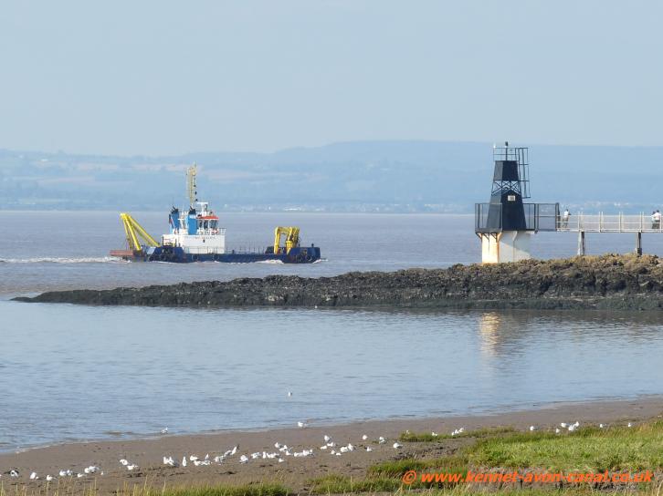
Going out to Portishead and taking a refreshing stroll at Portishead Point (Battery Point) Lighthouse
Built in 1931 and also known locally as Battery Point Lighthouse, the structure is in a bit of a dilapidated condition but is still active - it's certainly not a typical English lighthouse shape. Because of it's dominant view over the Severn, "Battery Point" was the site of four heavy anti-aircraft emplacements during the Second World War. With views across the River Severn of distant Wales and also in clear weather the Second Severn Crossing bridge visible, the area around it though is really pleasant to stroll around. There is also a one mile circular walk from there to try which just goes mostly through woodland.There is plenty of car-parking available along Esplanade Road, lots of bench seats to relax on and also a cafe and even a swimming pool and mini-golf available in the immediate area.
- You may be interested in our item about The end of The Kennet and Avon Canal at Entrance Lock in Bristol - From Hanham Lock into Bristol City via Bristol Mud Docks and reaching the end of the Canal at Brunels Entrance Lock.
- Please see our Visiting The Kennet and Avon Canal in England Home Page for all items about walking alongside the whole length of the canal itself.
Other items about England include The Grand Union Canal, The Stratford-on-Avon Canal and The Regents Canal - lots of walks in England including walking The Thames Path.
These can all be found via our Site Resources page.
Visit Resources if you wish to Contact Us. You may also wish to look at our Cookies and Privacy Policy.
These can all be found via our Site Resources page.
Visit Resources if you wish to Contact Us. You may also wish to look at our Cookies and Privacy Policy.